
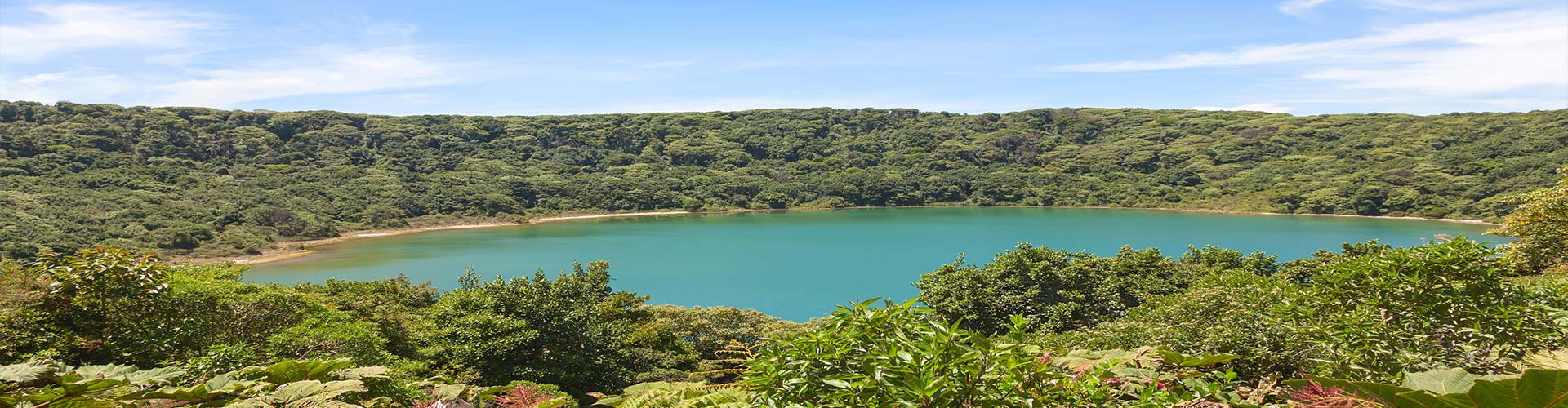
Costa Rica is a land of glorious diversity. From stunning beaches and exuberant rainforests, to the charm of its quaint towns, Costa Rica Guides shows travelers worldwide the best places to visit in this natural paradise.


It will be a pleasure to assist you with your Costa Rica vacation planning.
If you are visiting Costa Rica for either business or vacation, let us take care of all the details: Hotel Reservations, Costa Rica Tours, Costa Rica Vacation Packages, Private Transportation, Rental Cars, Shuttle Services and information on what to do, where to go and which places to see while you’re in Costa Rica.
We have been organizing Costa Rica vacations for over 24 years and we will be happy to help you with free information for a great Costa Rica trip.
Feel free to contact our representative office. From U.S.A or Canada please call: 1-877-281-8515 or call Costa Rica direct: 011-506-2233-5151. Our office hours are: 9:00 a.m. to 6:00 p.m. Monday through Friday (Eastern Time), or email us at [email protected]
Most Popular Tours
 $159.00
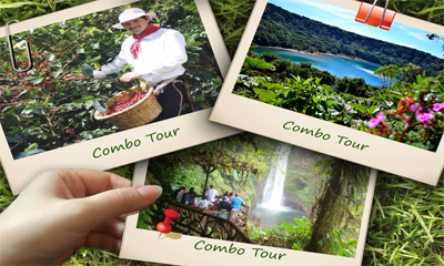
Combo Tour: Poás Volcano National Park / Doka Coffee Tour / La Paz Waterfall Garden
Remarks: Due to the altitude and activity of the Poás Volcano, this tour is not recommended to any person with
01 Dec 2020 - 30 Jun 2021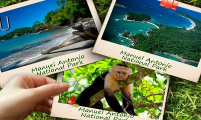 $137.00
Manuel Antonio National Park
Manuel Antonio National Park is considered one of the most beautiful parks in Costa Rica. On this tour, you will
01 Dec 2020 - 30 Jun 2021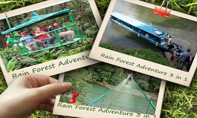 $158.00
The Authentic Rainforest Experience
Drive to Sarapiquí area, through the extraordinary rain forest of Braulio Carrillo National Park, one of the most important rainforest
01 Dec 2020 - 30 Jun 2021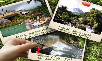 $219.00
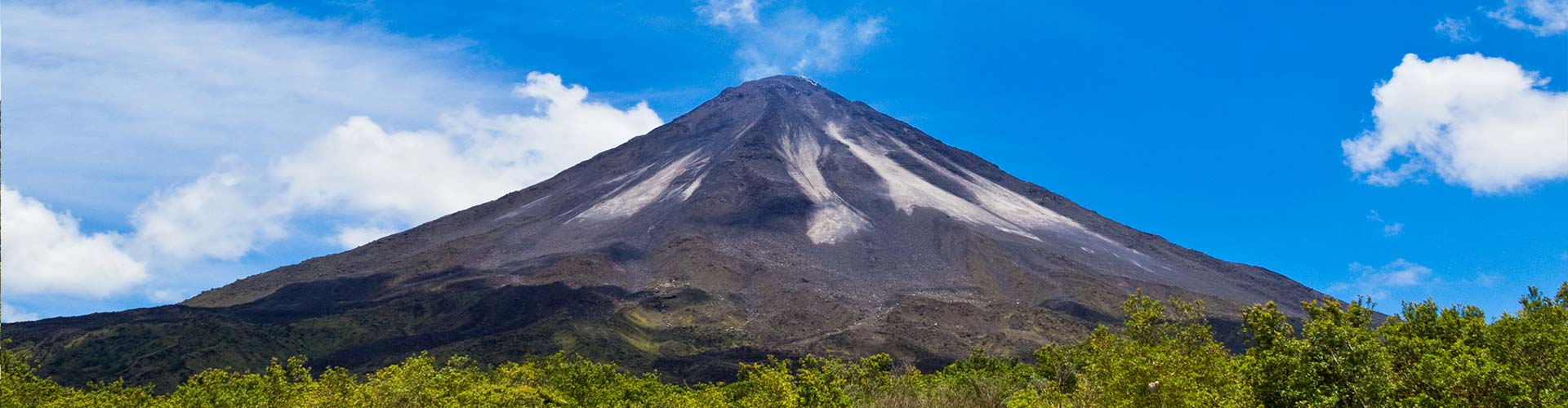
Arenal Volcano with Tabacon Hot Springs
Discover Costa Rica’s largest network of naturally flowing thermal mineral springs in Arenal’s largest and most beautiful private, rainforest reserve.
01 Dec 2020 - 30 Jun 2021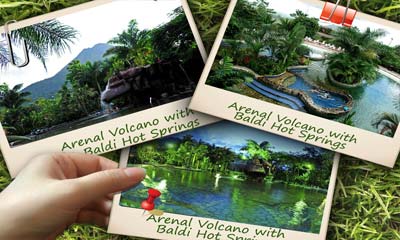 $173.00
Arenal Volcano with Baldi Hot Springs
The Arenal Volcano with Baldi Hot Springs tour is by far a favorite among travelers.This tour offers the auspicious site
01 Dec 2020 - 30 Jun 2021 $178.00
Arenal Volcano with The Springs Hot Springs
This tour allows visitors to experience the amazement of the Arenal Volcano, and then go on to the thermal waters
01 Dec 2020 - 30 Jun 2021 $122.00
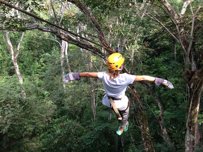
Canopy San Luis
Set into the placid cloud forests of Costa Rica’s Central Valley region, the San Luis canopy tour will take you
01 Dec 2020 - 30 Jun 2021 $62.00
San José Explorer City Tour
This tour immerses you in the rich Costa Rican culture and history by visiting some museums and historical sites of
01 Dec 2020 - 30 Jun 2021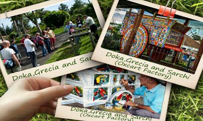 $73.00
Doka, Grecia and Sarchi (Oxcart Factory)
We take the Pan-American Highway towards the city of Alajuela. En route we will pass the Agriculture Monument, the Monument
01 Dec 2020 - 30 Jun 2021 $142.00
Adventure Combo
Costa Rica Guides provides White Water Rafting experiences that are guaranteed to take your adrenaline to top levels and Canopy
01 Dec 2020 - 30 Jun 2021Client Testimonials
“It is true that my wife, Dr Gunter, did not use the pool at the hot spring. That is because her idea of a relaxing time is to sit beside a beautiful pool while sipping delicious juices and enjoying the scenery — which is exactly what she did. And we both had a WONDERFUL time at the pool, at the volcano, and at the churches. I can’t say enough good things about your company. My wife is saddened that her work at the local University tomorrow will not allow her to be with me.
Again, my thanks to all of you for a wonderful day!”
Paul Rabe
Paul Rabe
“ This trip was truly a trip of a lifetime for both my husband and myself.
We felt it was organized very well and set at a relaxing pace allowing us to see many beautiful areas of Costa Rica. Every detail was thought of and planned for.
The highlight of the trip was our tour guide Miza. His passion for his country was so genuine that we couldn’t help but get caught up in his excitement for all the beautiful flora and fauna.
Having Miza and Niko in charge we were able to sit back and relax. We felt very confident having Niko as our driver. He was a very competent driver and faced difficult situations with grace- escape hatch blowing off/ tree falling on bus.
Miza was very kind to wait with our group while we zip lined in Monteverde. I was nervous to do it and I found knowing that Miza was waiting there for us while we did it gave me peace of mind. He truly lived up to his name PaPa.
He was always looking out for us making sure we were comfortable and happy.
It was nice that we had the flexibility of stopping at grocery stores on route to pick up whatever supplies we needed.
Sincerely,”
Christine Bedgood-Fraser and John FraserChristine Bedgood
“ It was lovely to meet you at both the opening and closing dinners for Mazine Group of Costa Rica tour in February.
This was our second trip to CR with Mazine, and it was as exciting and enjoyable as the first. The choice of accommodations and different climates within the country made the trip very interesting and informative.
We were especially thrilled that Miza and Niko were our “guardian angels” for this trip, as they were with us on our first trip, and both made our time very memorable. Miza is unbelievably knowledgeable about his country, and made our days safe, as well as fun. I’m sure there is nothing we could have asked for or needed that he could not have provided for. His and Mazine Group handling of Bert’s accident was to the highest standards possible, not to mention your own care and attention to him once he was in hospital.
Niko is an excellent driver and very polite, and very kind in helping folks on and off the bus and seeing to their needs. He could not have been more gentle and conscientious driving over some of the roads.
Overall, Sugey, we had a fantastic time. Your company does a wonderful job of providing lifelong memories to their clients, and I will not hesitate to recommend them to my friends. As Costa Rica seems to be more and more of a destination for North Americans, I’m sure you will be very pleased with the number of clients coming your way.“
Best regards. Thanks again for all your organization.
Dawn MacKay
“Just wanted to drop a short email to thank you so much for the wonderful experience we had while travelling in your country. We were part of Mazine Group of Costa Rica.
It was our first experience on a bus tour so we had no prior knowledge of what to expect. From the very beginning we were treated like royalty. Every detail was looked after.
Miza and Niko, yourself and Mazine looked after all our needs and our safety with great care.
We saw an amazing amount of your country in our 15 days. We now have a better understanding of your cultures,foods and language and wildlife. Miza was entertaining and very knowledgable as he attempted to teach us Spanish and some of the history of the country.
Niko was an amazing driver on the mountainous dirt roads that we encountered. Costa Rican massage! Even when the escape hatch blew off in a wind storm or when a tree fell on the roof there was no panic!
Sugey, the way you handled the situation with Bert was incredible. We were kept informed on his condition all the time. It truly made us feel safer knowing that emergencies where handled so well.
So in closing it takes a truly dedicated team to have shown us such a great time.
Thank you!! “
Sue Falloon
“We want to personally thank you and your company for the way you went above and beyond duty for us.
We have now travelled 3 times to Costa Rica with Mazine and have always had Miza and Nico as our guide and busdriver.
We cannot express how much we have enjoyed everyone connected to expediciones tropicales. We truly feel you are like family.
We will spread the word about you and your marvellous company to friends and family.
We wish you all the best in the future and hope to see you again someday. Bob and Frances Paulin“
Frances Paulin